Tuesday, September 20, 2011

Ireland Revisited: Afterword

412 years ago, my 10th-great grandfather, John Harrington, included the following in a report to his godmother the Queen on his recent deployment to Ireland:
I have informed myself reasonably well of the whole state of the country, by observation and conference: so I count the knowledge I have gotten here worth more than half the three hundred pounds this journey hath cost me.
If I ever meet Sir John, I'll tell him that I got the other 150 pounds' worth.

I'm not going to be as bold as he was with my assessment after two deployments, though. While I think this pair of Harringtons is now reasonably well informed about certain aspects of Ireland that we knew nothing about before, we are also well enough informed to know that the "whole state" of any country, even one as small as that one, is beyond us.

Our first reconnaissance is done, though, that much is certain. What comes next will be very different from exploration of geography -- I doubt very much that any future visits will lend themselves to a daily account or mapping. Instead, what I think lies ahead for Ireland and me is some in-depth research on some very specific topics. The precise form of what comes out of that research will depend in large part on what's uncovered in it, but I know who its central figure will be, and he's not one I would have expected before this second trip to Birr.

Laurence Parsons, Fourth Earl of Rosse, may not have been a riveting intellectual giant like his father or a reckless technological and industrial giant like his younger brother, but by virtue of time and position he ties together a parade of fascinating personalities and a sea change in the way we all live our lives. His time spanned from the first automobile tragedy to the runup to WWI's mechanistic horror, his astronomy bridged from the gentility of a country gentlemen's avocation to the first mountaintop professional observatory run by a modern university, the geography of his story spans from Birr to Santa Cruz. The next steps in research are to try to get a sense of the man himself beyond his brusque diary entries and to fill in more details concerning his week in Northern California in 1891 -- including trying to crack the mystery of those four blank diary pages.

As concerns the latter, I'm anxiously awaiting the re-opening of the Lick Observatory Archives at the University of California, Santa Cruz, just down the road from my home here in Boulder Creek. The archives have been unavailable for many months due to facilities renovation, but should reopen before the end of the year, and I'm anxious to see if I can find more about the Fourth Earl's interactions with the Lick staff of the time, including the Observatory's blustery (and largely unpopular) first Director, Edward Singleton Holden. I know a little something about that particular cast of characters already, having worked as an editor and archivist for the Astronomical Society of the Pacific, an organization founded by Holden in 1889.

As concerns a sense of the man himself, I suspect that will require getting dusty in Armagh and Trinity College, Dublin for starters. The archives at Birr, fascinating as they are, primarily show only one end of conversations: letters received. Letters from Lord Rosse to the astronomers at Armagh and writings of his during his long tenure as Chancellor of Trinity College should help give more insight than his short diary entries do.

This will be fun.

================================

A few footnotes:

A big difference:

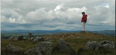
The biggest difference to us between our 2006 visit and this one four years later is not a hard call: it's the ease of getting around Ireland on the roadways. The reach of "dual carriageway" superhighways from Dublin now radiates to all of the island's other major cities, and no place in Ireland is more than a couple of hours by car on good, modern roads from Dublin, Sligo, Galway, Limerick, Cork, or Waterford. It is as though all of the US had made the transition from 1930s roads to a complete modern interstate network in less than a decade, and the effects on the character of Ireland will be profound and permanent. The network was just in its finishing stages in August, 2010. The following video clip shows eight minutes of a drive along the M7/N7 toward Limerick, and gives a pretty good flavor of the magnitude of the transition. The first third is along a new superhighway (the M7), the middle third is along a new connecting road from the superhighway to a village, and the final third is along the N7. The connecting road is typical of new non-superhighway roads which have also proliferated across the island, and its breadth and clear sight lines bear little resemblance to the narrow, hedgerow-walled roads they replace. The N7 from Birdhill westward in the last part of the clip is typical of what constituted a major national highway during our 2006 visit.


(The banter between Diane and me at the roundabout refers to a joke I had cracked during a visit with Lord and Lady Rosse about how American tourists might be miffed that the Irish seem to be intent on not remaining picturesquely impoverished and quaint.)

Photos in a trice:

A link to this has been posted on this blog before, but it's sensible to repeat it here: all of the 700-plus photos in the albums of this trip over on sharrington.net can be seen in rapid-fire on this YouTube video in only six minutes:


Plans gang agley:

Back in July of 2010, this SherWords post invited readers to hold on to a map of our intended travels to compare with what actually happened. Just in case you've lost yours, here are the two maps -- planned on the left and actual on the right.

Evidently, a major ankle injury tends to sag one's peregrinations down and to the right.

Which leads to this closing note: I knew before that my wife is a tough cookie who doesn't let a little pain stop her. I just didn't quite appreciate the magnitude of her grit. If it had been me taking a tumble off that stile in County Antrim, I can guarantee you that a lot more of our days would have looked like August 26.

================================

Wednesday, September 7, 2011

Ireland Revisited: Across the Western Ocean

Day 35 of 35: Tuesday, September 7, 2010

Ronnie Wood of the Rolling Stones stayed in the room next to ours the night before our departure. He's 19 days older than I am, but looks 19 years older, at least, and I guess that's what comes of packing so much fun into your life. No rock star shenanigans that night: the only noise coming from that direction was the occasional knock on his door by what we figured was his manager or agent, shouting "Ronnie! You have to be at [xyz] in [abc] minutes!" Carlos Santana didn't look like he needed such shepherding, but, then again, Carlos is a whole month younger than Ronnie and me. We didn't bother Mr. Wood beyond simply nodding to him as we passed him in the lobby.

Homeward bound:

To the airport, early morning. To American immigration (which no other foreign country has at the Dublin airport.) To Aer Lingus. To Chicago. To United to San Francisco, to Adam, to the pickup truck, to home.

US presence in Dublin's airport. (This is the "old" passenger terminal; the new one opened just a few weeks later and incorporates the most comprehensive US Customs and Immigration station outside the Western Hemisphere.)

Aer Lingus's "St. Aoife" at the Dublin Airport as we awaited departure. This was the aircraft that brought us from Chicago to Dublin weeks before – but here it was about to take people to Boston; ours was to be the next flight out after that.

The trip home was largely uneventful, unlike last time, and gave no opportunity for a dramatic end to this narrative.

And that's fine by us.

==================================
All of the sets of additional images from this trip can be accessed through this index page over on sharrington.net.
==================================

Next and last -- Afterword (to be posted after a few days' break)
Previous: September 6, 2010 -- Dublin in the Rain
Beginning of the series: Prologue, August 2

Tuesday, September 6, 2011

Ireland Revisited: Dublin in the Rain

Day 34 of 35: Monday, September 6, 2010

Our last full day in Ireland this time was a very rainy one, spiked by the obligation to return our rental car by the middle of the afternoon. Fortified by our experience on Saturday, we braved Dublin’s traffic by driving into the city in the morning, parking in a garage near Saint Stephen’s Green. We left the big, expensive camera back in the hotel because of the rain… and Diane’s little Canon point-and-shoot didn’t work well, so we have very few photos of this day. It’s just as well; we were so sad to leave that the mist and the gray and the drizzle fit our mood better than any photo could capture.

Park Lake in the rain, St. Stephen's Green.

Sherwood (blue jacket) shopping on Nassau Street.

Back in the hotel, starting to pack.

==================================
The full set of slideshows from this trip will be linked at the end of tomorrow's installment.
==================================

Next: September 7, 2010 -- Across the Western Ocean
Previous: September 5, 2010 -- The Mountains of Mourne
Beginning of the series: Prologue, August 2

Monday, September 5, 2011

Ireland Revisited: The Mountains of Mourne

Day 33 of 35: Sunday, September 5, 2010

Drifting in the rain on Carlingford Lough.

Postponed to last by circumstance, we finally drove up from Dublin toward Belfast and swerved right at Newry in County Down (UK) into the Mountains of Mourne. Diane had wanted to see this storied part of Ulster for a long time, and we had initially planned to go there early on in our trip, but circumstances kept pushing us back toward the end.

The day was wetly gray, and seemed played in a minor key. As we drove, we kept turning the car's radio on to get news of something we knew nothing about a few weeks before: the All-Ireland Hurling Final being played in Croke Park, Dublin. The match on this day, roughly the Superbowl of the GAA, was between Tipperary and perennial powerhouse Kilkenny. Both county colors -- black and amber for Kilkenny, blue and gold for Tipp -- had been on prominent display in flags and pennants all over both counties throughout our travels, and we couldn't help but get interested in what was going on. Tipp won in an upset.

In the Mountains of Mourne.

Southward-looking panorama from near Hilltown, County Down.

After a misty ramble through County Down’s highlands, we drove down southward toward the coast at Kilkeel:

… and then westward and northward along Carlingford Lough back toward Newry and the border, then back to the Republic. (Despite the sound of its name, Carlingford Lough is not a lake, but rather an inlet of the Irish Sea. It forms the easternmost part of the border between counties Louth and Down, between Leinster and Ulster, and thus at present between Ireland and the U.K.)

Deep water port equipment at Greenore, on the south side of Carlingford Lough, in the Republic.

Along our drive back through the rain to Dublin, we took a detour toward the border near Dundalk, looking for a settlement named Drumboat for our friend Ronnie Peterson, part of whose ancestry comes from there. We were not successful in locating the place, and rain was coming down so hard by then that we abandoned the search after wandering into Northern Ireland once again, but we know where to look next time!

==================================
More images from this rainy day in the mountains and around Carlingford Lough are available here.
==================================

Next: September 6, 2010 -- Dublin in the Rain
Previous: September 4, 2010 -- Moving Day
Beginning of the series: Prologue, August 2

Sunday, September 4, 2011

Ireland Revisited: Moving Day

Day 32 of 35: Saturday, September 4, 2010

Moving day. Sighing day.

Heading out the door, September 4th.

We left the Bothy today, headed back to Dublin and ultimately to Boulder Creek, and, as four years ago, sadness hung around us like a mist. We love this place.

Ready to go.

The day was taken up with the now-short drive (thanks to the new M7 motorway) to Dublin and checking back in to the Radisson Blu hotel at the airport (or “rad-ISS-un SASS” in the funky dialect and outdated business vocabulary of our satnav’s speech imitation routine.) Rain began to pick up pick up as we left Birr, and intensified as we approached Dublin. The weather had almost precisely coordinated with the calendar in switching from high-tourist season in August to September’s lower expectations. It felt comforting, in a way.

Not a rocky road.

As we approached Dublin, we decided to drive into the center of the city instead of using the ring-road M50 superhighway to avoid it. We wanted to see, on this weekend day, if driving there would be comfortable. We still had two full days ahead of us before our flight home, and wanted to spend one of those days in the city; driving would be a more efficient use of our time for that than the bus would, but only if we thought we could tolerate it.

We're glad we did drive through Dublin on this rainy Saturday. It was a nice way of sightseeing, and traffic was light. From our experience, Dublin isn't a particularly harrowing city to drive in, as long as one is accustomed to driving on the left (as we were by then.) In fact, it's pretty pleasant compared to large American city centers.

==================================
More images from September 3 and 4 are available here.
==================================

Next: September 5, 2010 -- The Mountains of Mourne
Previous: September 3, 2010 -- Last Full Day in Birr
Beginning of the series: Prologue, August 2

Saturday, September 3, 2011

Ireland Revisited: Last Full Day in Birr

Day 31 of 35: Friday, September 3, 2010

Hornbeam hallway in the Cloisters, Millennium Gardens, Birr Castle Demesne

Our last full day in the Demesne was mostly spent in the Bothy packing and cleaning; Diane's ankle was too sore from yesterday's trudging up and down the Hill of Uisneach to do much beyond that.

I took a last early-morning walk, including a visit to the brick bridge over the Little Brosna and, of course, to see our friend near her new palace.

The annual trimming of the Millennium Gardens' hedges had been completed the day before, and they looked mysterious in the early morning mist (top) and grand in the later morning’s full sunshine.

In mid-morning, I went over to the Castle, where I had invited myself to take snapshots of our host and hostess. Lady Rosse offered to take a photo of me wherever I wanted; I chose the “Yellow Room,” where we all had a great time two Fridays ago. Especially given the pioneering achievements in photography by a previous Countess of Rosse, I am tickled to have a photo of myself in Birr Castle taken by the current Lady Rosse. (The fact that it's a really nice picture helps a lot, too!)

A count, a countess, and a no-account.

They are delightful people, and we’ll miss them.

I finished the benches’ panoramas project with views from two near the castle, favorably illuminated in evening’s sidelong sunlight. Along the way, I took one more look at the reconstructed Leviathan, still not operational but still a stirring sight for those who know its story.

When we arrived in early August, the castle's ivy was all a lush green. As we prepare to leave, its walls are well along the way to changing their seasonal wardrobe.

==================================
More images from this day will be available in a two-day set that will be linked at the end of tomorrow's installment.
==================================

Next: September 4, 2010 -- Moving Day
Previous: September 2, 2010 -- The Hill of Uisneach
Beginning of the series: Prologue, August 2

Friday, September 2, 2011

Ireland Revisited: The Hill of Uisneach

Day 30 of 35: Thursday, September 2, 2010

Uisneach Denizens

This was to be our last true vacation day headquartered in the Bothy; Friday, our actual last full day, would be taken up mostly with packing to leave early the following morning. Today broke with clear skies and a light mist on the ground.

Two-panel panorama of the Bothy in the early light of September 2nd.

After I took a brief trip to the library and its internet connection, we set out for the Hill of Uisneach near Mullingar, said to be the ancient center of Ireland.

Along the way, we took an unplanned detour to see the southernmost tip of Lough Ennell through which the River Brosna flows (Mullingar is at the northern end.) The lake appears to be a great recreation asset for the local people, well away from tourist attractions and, of course, beautiful.

This area at the lake is called “Lilliput,” because of Jonathan Swift’s connection to the region: he frequently retreated to this area in general and this lake in particular to gain solitude for writing. A sign near the shore at this place provides a map of the Mullingar region for bicyclists and reads:
It’s time to take things slowly… Quiet country roads with stunning views of rich pastureland and beautiful lakes provide the ideal backdrop for your cycle routes. Enjoy some fresh air, peace and tranquility. Mullingar is your starting point. A busy market town with excellent facilities and amenities, Mullingar is finely situated on the River Brosna near the ancient centre of Ireland. Visit the beautiful Renaissance style Catholic Cathedral and admire breath-taking frescoes. Visit the local tourist office at the Market Square and see the statue of the late Joe Dolan, commemorating the life and music of Mullingar’s own and internationally renowned singer and entertainer. Venture north to Lough Owel and on to Multyfarnham with it’s [sic] 13th Century Franciscan Friary. Follow in the steps of ancient Irish warriors on the Táin Trail and cycle alongside the Royal Canal, built in the 1800s, and now a recreation amenity and wildlife haven. Cycle south around Lough Ennell, relax at Lilliput amenity area and visit the 18th Century estate at Belvedere where bike parking facilities are available. Whichever route you choose you will enjoy a pleasant cycle in a gentle landscape rich in lake and canal, lore and legend.
I’m sold, but I have no bicycle.

From the lake, we backtracked to our original destination, the Hill of Uisneach (pronounced “Oosh’-nuk”.)

The hill is not on public land, or administered by the OPW. It is on a working farm, and permission to enter should be obtained from the owner. The farmhand who gave us our map of the hill (left over from a Mayday celebration there, an annual New Age spiritual gathering called "the Festival of the Fires" at the traditional center of Ireland) also gave rather ambiguous directions for the easiest walk to the top. Against Diane’s better inclinations, she followed her husband on what turned out to be a very circuitous and rather arduous trudge through pastureland up the 600 feet or so of vertical relief. Not bad for someone on a bum ankle.

Clockwise from upper-left: Parking area and sign on the R390 road west of Mullingar, Diane trudging, more Diane trudging, and curious cows.

The summit features a variety of recent structures, mostly wicker – and an incredibly stunning 360° vista to the far reaches of Ireland. From that point, it is easy to understand why this place has been special in a number of ways for thousands of years.

==================================
More images from September 2nd, including a very large, 360° panorama of the view from the top of the Hill of Uisneach, are available in this slideshow on sharrington.net.
==================================

Next: September 3, 2010 -- Last Full Day in Birr
Previous: September 1, 2010 -- A Midlands Ramble
Beginning of the series: Prologue, August 2

Thursday, September 1, 2011

Ireland Revisited: A Midlands Ramble

Day 29 of 35: Wednesday, September 1, 2010

Dominican Priory ruins, Lorrha, Co. Tipperary

As we headed into our last three full days in the Irish midlands and I had finished my time in the archives for this trip, the urge to do a lot of running around to many places became almost overwhelming. Before Diane got going on this morning, I made a quick trip to the little village of Lorrha at a nexus of very back roads between Birr and Terryglass on Lough Derg, through which we had driven the previous evening on our way back from dinner at the Derg Inn. Lorrha turns out to have a number of attractive ruins in its vicinity, including the Dominican Priory, established in the 13th century and now serving as a graveyard adjacent to a modern church.

Details, Dominican Priory, Lorrha.

Once Diane was ready to go, we started on a three-county, generally west-to-east meander across nearby parts of the midlands. We started in Portumna, County Galway, a familiar town to us because we had traveled through it many times in 2006 and on this trip. We had always intended to visit Portumna Castle, but never seemed to have the time. We did so, finally, on this day.

Portumna Castle.

The castle – really an Elizabethan-style mansion – was built in the 17th century as the Irish headquarters of the English Clanrikarde family. It was almost entirely destroyed by fire in 1839, leaving only the stone outer walls intact, and was abandoned. The ruin was taken over by Ireland’s Office of Public Works (which administers and operates Ireland’s public antiquities sites) a few decades ago, and the OPW has been slowly restoring the place to an approximation of its 1700s state since the 1960s. Progress is slow because funding is sporadic. So far, only the ground floor is in shape for the public to visit.

From Portumna, we meandered back through the rural environs of Lorrha in North Tipperary, to look at a tower house in a farmer’s fields (Lackeen Castle), and then on to the town of Banagher on the Shannon in County Offaly.

Lackeen Castle (top) and Banagher's bridge across the Shannon.

Finally we followed the Shannon eastward and upstream to the ancient monastic ruins at Clonmacnoise. We had visited Clonmacnoise in 2006, and returned this time as much for its view of the Shannon as for the ruins themselves.

Clonmacnoise, the Shannon, and a fellow visitor.

And, then, finally home to Birr, the Demesne, and the Bothy. An evening stroll gifted us with a short visit with Miss Kitty, another with Lord Rosse (who was driving back from somewhere in the Demesne’s far reaches), and…

… two sociable horses and some of the last vestiges of the weekend’s fair.

==================================
More images from this day's wanderings are available in this slideshow on sharrington.net.
==================================

Next: September 2, 2010 -- The Hill of Uisneach
Previous: August 31, 2010 -- Back to Brú na Bóinne
Beginning of the series: Prologue, August 2